Land North of Mosley Common

Welcome to our Masterplan Vision Community Consultation

Update

Wigan Council has approved Peel L&P’s masterplan vision for Mosley Common. The plans will create a new community in Wigan, with a mix of homes including affordable housing, parklands, a transport hub and 200 new jobs. You can learn more about the vision below.

You can also read more about the decision here.

Welcome

Peel L&P is developing plans for high quality, sustainable new homes at Land North of Mosley Common.  The proposals for Land North of Mosley Common will deliver high quality, sustainable new homes in a variety of styles and sizes to meet the needs of local people, from starter homes to larger family homes as well as homes for those looking to downsize. Around 25% of the new properties will be affordable homes suitable for buyers struggling to get on the housing ladder. It represents an opportunity to create a truly balanced community, which is socially inclusive and provides for people at all stages of life. The homes will be set in network of greenspaces with access to new parklands. Additionally, with the local transport connections, the site will have unrivalled connectivity, making it a great place to live, work and play.

Wigan Council recognises the significant opportunity and contribution that the Land North of Mosley Common can make to meeting the housing needs of the Borough and Greater Manchester as a whole. The Council has proposed the allocation of the site for around 1,100 new homes in the emerging Places for Everyone (PfE) Plan for Greater Manchester, which has recently been submitted to the Secretary of State for Examination in Public.

One of the requirements of the Plan is for a masterplan to be consulted upon with the community before approval by the Council. This community consultation is the first step and sets out Peel’s vision for Land North of Mosley Common. You can find out more about the masterplan vision on this website.

We want to hear your views on our masterplan vision for Land North of Mosley Common. Please take the time to read through the information available on this website and let us know your comments. All feedback will be reviewed in detail and will help inform the development of the masterplan.

Register for our Webinar

As part of the consultation process, we are hosting two webinars. These are online events where the project team will talk you through our plans and then answer any questions you might have.

We have two webinars scheduled from 6pm until 7pm on Thursday 10th March and Wednesday 16th March.

You can register for the webinars by clicking on your preferred date below:

Thursday 10th March – 6pm to 7pm

Wednesday 16th March – 6pm to 7pm

What can the Land North of Mosley Common be?

The preparation of the masterplan vision has been informed by three key drivers:

People

Land North of Mosley Common will be a welcoming and accessible place for all. It can provide a wide range of new homes to meet the needs of different households, including affordable housing. A substantial network of parks and green spaces, with improved and new connections with the local area will be provided. Community facilities will also be provided to meet local needs, including investment in local primary school facilities and a Community and Travel Hub.

Place

The masterplan vision will provide a range of attractive neighbourhoods that are unique in character and reflect the natural assets of the site. The network of green spaces will promote healthy lifestyles whilst maximising the ecological value of the site. The masterplan vision will integrate with existing neighbouring communities, creating sensitive boundaries and providing access to new facilities.

Movement

The site is very well located to maximise the use of public transport, cycling and walking. A new Guided Busway stop will be located within the centre of the site with an adjacent Community and Travel Hub connected to a network of new footpath and cycle connections. The bus stop will be located within an attractive parkland setting with community uses to promote the use of sustainable transport.

Our Vision

The Land North of Mosley Common will be a new high quality residential community and a logical extension to Tyldesley. It will provide much-needed new homes for all stages of life set within an extensive multi-functional parkland with unrivalled connectivity.

Nature Recovery and Enhancement of the Natural Assets

The development will preserve nature whilst creating green spaces for both existing and new communities to enjoy. The masterplan vision is based on a detailed understanding of the existing landscape, drainage and topography. It ensures that ecology, access and surface water management work together to create quality green spaces.  

Multi-Modal Sustainable Movement

Mosley Common will be a place that actively supports health and wellbeing with a network of sustainable and safe active travel routes throughout the site with a bus stop and Community and Travel hub at the centre of the development.

Connected Communities

The entire development will be within walking distance of a Community and Travel Hub, and Guided Busway stop providing connections across Wigan and Greater Manchester. It will be a meeting point where communities can gather and socialise as well as commute.

A Rich Mix of Neighbourhood Types

A series of neighbourhoods with individual character will provide a wide range of new homes to meet the needs of different sectors of the community for all stages of life.

A Hamlet at the Heart of Mosley Woods

Low density, high quality housing in a parkland setting will create a unique character at the heart of the development.

Arrival in Nature

A welcoming green space will greet bus users as they disembark at Mosley Woods, inviting people to explore the environment.

Phasing and Delivery

Peel is one of the UK’s leading developers. It has a specialist team with a proven track record in bringing forward major development proposals that range from high density mixed-use developments on complex brownfield sites to major sustainable urban extensions.  Peel has a long term commitment to the Land North of Mosley Common.

Peel will perform the role of Master Developer delivering infrastructure and green spaces to support housing delivery.  Its housebuilding arm, Northstone, will build the first homes and some other phases of development. Over time, land will be released to other housebuilders to ensure that the site delivers new homes as quickly as possible to meet urgent local needs and to offer choice.  The development will be delivered across three to five phases of which each will deliver around 30 to 50 new homes per year. This reflects the strength of the market in and around Tyldesley and Walkden, the scale of demand for new homes, and Peel’s recent experience of delivery in other similar and nearby housing markets. The delivery of new infrastructure (Community and Travel Hub, Guided Bus Stop, public open space and recreational areas) will also be phased throughout the build period via a programme agreed with Wigan and Salford Councils and other stakeholders including TfGM.

Click to enlarge

Post-Pandemic Living

The challenges experienced over the Covid-19 pandemic have shown the importance of communities where residents can live, work and play. Land North of Mosley Common will be a leading example, through the provision of homes alongside varied green spaces with a distinctive Community and Travel Hub and local services on the doorstep.

Land North of Mosley Common will incorporate several fundamental principles that have been brought to the forefront during the Covid-19 pandemic. These include:

Click to enlarge

History of the Site

Land North of Mosley Common is a suburb of Tyldesley on the eastern edge of the borough of Wigan.

The original name for the wider area was Hurst which meant Wooded Hill. By the Victorian era, the landscape was largely agricultural with only some woodland left.

The area has a rich history of industry, as a major centre for coal mining and textile manufacture. The surrounding coal mines were part of a group of independent companies called the Manchester Collieries operating on the Manchester Coalfield. Many collieries in the area, including Mosley Common, were owned by the Bridgewater Trustees. Mosley Common Colliery was the largest on the Lancashire Coalfield.

Mosley Common Colliery opened in the 1860s with the adjoining brick works opening at Ellenbrook shortly after. Both the Colliery and brick works remained open until around the 1960s. Whilst most of the structures associated with the brickworks have mostly been demolished, ruined remains of several structures remain.

Site Opportunities and Constraints

Key technical and environmental opportunities and constraints have been identified in preparing the masterplan vision for the site. These include:

Site Opportunities

  • Provision of multiple highway access points, including from the A5082 Mort Lane, Bridgewater Road, City Road and Wellington Drive.
  • Including a new stop on the Guided Busway and providing and improving links to existing Busway stops to the east and west.
  • Connections to local bus services.
  • Improvements to footpath and cycleway links, including to existing Guided Busway stops, Walkden rail station, Route 55 of the National Cycle Network and nearby local centres.
  • Links to wider green networks, including enhancement, links to and management of the woodlands and Sites of Biological Interest.
  • Retention of trees, hedgerows and other habitats of value.
  • Provision of a green spaces that improve habitats and ecology through new wildlife corridors, planting and water bodies.
  • Existing watercourses, including the Honksford Brook.
  • Delivery of a comprehensive SuDS network.
  • Investing in improvements to primary school facilities in the local area

Site Constraints

  • Existing woodland, hedgerows and other habitats of value, including adjacent Sites of Biological Interest.
  • Existing watercourses throughout the site.
  • The Guided Busway dissects the site east-west.
  • Gently undulating topography.
  • Existing farm buildings with local heritage value.
  • Gas pipeline with an easement dissecting the site.

Wider Strategic Connections

Use the buttons below to highlight different elements of the strategic connections for the site.

Masterplan

The masterplan vision uses the existing natural environmental features (woodland, mossland and watercourses) on the site to create a varied landscape corridor offering a wide range of uses.  The corridor provides areas for ecological improvement and woodland restoration but also a series of green spaces and parkland for recreation. 

The landscape corridor defines a series of separate but connected neighbourhoods.  These neighbourhoods will have their own character, informed by the landscape features which adjoin them, including a hamlet made of a small number of houses. 

The Guided Busway stop is at the centre of the site next to a Community and Travel Hub which will  include a range of community and mixed uses and will be in a parkland setting.  The combination of uses and environment bring life to the proposed Guided Busway stop, create an unrivalled arrival experience for users and a destination to visit.

Safe travel routes connect existing and new communities to the parklands. Landscaping along and around the Guided Busway will be improved to provide a welcoming environment for the many users of this route. 

The masterplan document can be accessed on Wigan Council’s website or by clicking here. 

Masterplan Concept

Masterplan Neighbourhoods

Tyldesley Fields

  • Landscaped Gateway from Mort Lane
  • Informal Playful Character facing onto Northern Boundary
  • Sustainable Active Travel Routes
  • High proportion of homes overlooking green space

Honksford Meadows

  • Connection to Brook Corridor
  • Lower Density Homes overlooking New Brookside Parkland
  • Relationship to Recreational Activities
  • High proportion of homes overlooking green space

Platts Fold Fields

  • Landscaped Gateway from City Road
  • Connection to Heritage Assets
  • Relationship with Ecological Corridor
  • Sustainable Active Travel Routes
  • High proportion of homes overlooking green space

Mosley Village

  • Higher Density Homes
  • Later Living
  • Formal Landscaping and Water Features
  • Green Avenues
  • Connection to Mosley Woods & Parr Bridge Retail
  • Pedestrian Gateway from Mosley Common Road
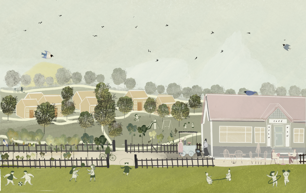
Mosley Woods

  • Parkland Landscape with areas of Woods.
  • Water Features create setting to Farm Buildings
  • Hamlets at the Heart
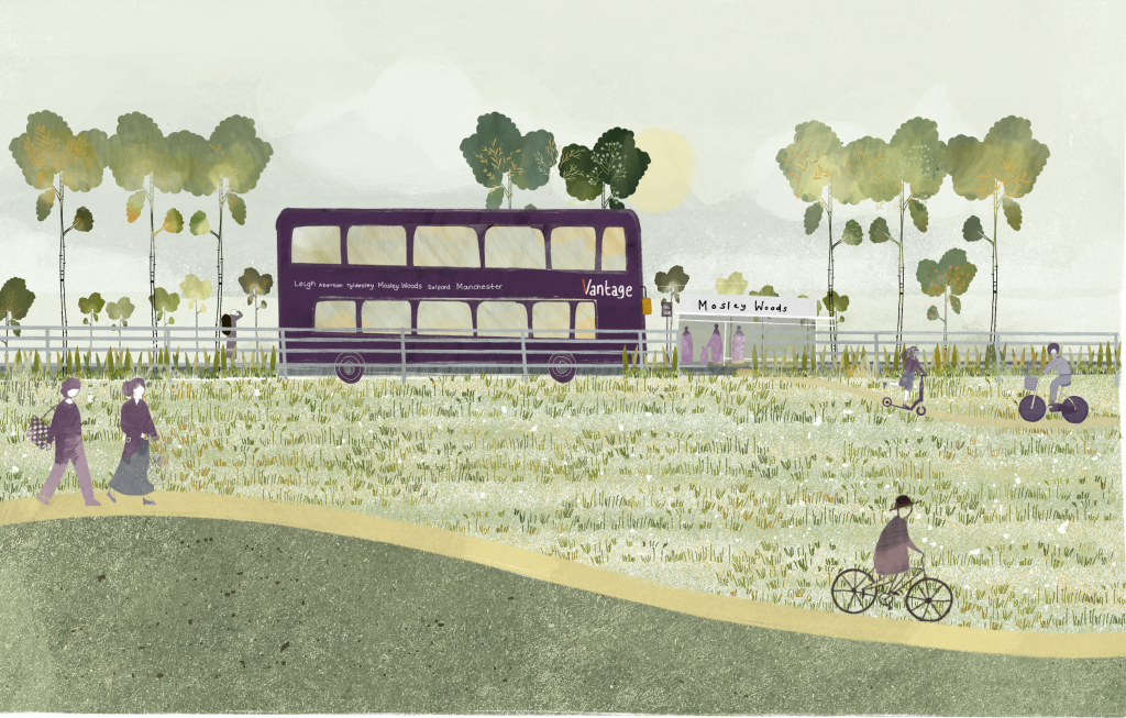
  • Community Hub at Mosley Woods Bus Stop Arrival
  • Low Density High Quality Homes set within Landscape
  • High proportion of homes overlooking green space

Bridgewater Village

  • Homes overlooking Rich, Biodiverse
  • Landscape of Mosley Mosslands
  • Connections to Mosley Common & Mosley Mosslands
  • Family Homes & Higher Densities
  • Green Pedestrian Links Permeate through Neighbourhood

Illustrative Masterplan

Landscape Vision

The vision for the development is underpinned by a comprehensive landscape scheme. The existing network of woodlands and watercourses will be used to create a diverse, generous parkland destination as the focal point to the new community. This large parkland will have variety throughout, responding to the natural characteristics of the site, to create an area rich in wildlife and recreation opportunities to benefit new and existing residents.

The landscape vision is guided by the following design principles:

Destination Parkland:

  • The site provides the unique opportunity to create a range of diverse, connected, public green spaces.
  • Mosley Mosslands will be a wetland park destination with a landscape that changes throughout the seasons.
  • Honksford Meadows will include play, recreation opportunities and ecological enhancements.
  • Mosley Woods will improve the surrounding wooded landscape.

Sensitive Edges:

  • The development will respect surrounding settlements, retaining important views and respecting neighbours boundaries. Integrating existing public rights of way into the masterplan and incorporating strong planting will connect the development to its surroundings.

Ecological Enhancements:

  • Honksford Brook is a key ecological area that will be protected and so development will be set back from the brook.
  • There is an opportunity for woodland enhancements, through provision of additional woodland planting, to connect habitats on site to the adjacent woodlands to the east.


Integration of a multi-functional network of public open space:

  • In addition to the larger parkland destination, a series of smaller parks will be located throughout the development to provide high quality, useable green spaces on resident’s doorsteps. These parks will help to create space for a variety of play and recreation facilities. This will include informal open spaces along with formal facilities with play equipment for children of different ages. This will include at least 4 play areas. 

The design will retain the best of the site’s existing features, landscape character and local context. It responds to the issues of ecology, access, landscape and drainage, to create a multi-functional landscape of benefit to the existing and new communities.

Click to enlarge

Sustainability Vision

Site Considerations

The masterplan has been informed by a range of technical assessments to confirm the suitability of the Site for development. These assessments have identified that:

  • There are no significant constraints to development at the Site which cannot be addressed through careful masterplanning and typical mitigation measures.
  • The Site provides significant opportunities to create a high quality residential community, whilst protecting valued environmental and recreational features.


Whilst technical work is ongoing to continue to inform the masterplan, outlined below is a summary of findings to-date:

Movement

Access

The development will benefit from numerous access points. The principal access point will be from the A5082 Mort Lane with other vehicle accesses from Bridgewater Road to the south, and Wellington Drive to the west and City Road to the east. These access points will serve different parts of the development which will enable traffic to disperse throughout the local highway network.

Initial options for the access arrangements are shown below:

Mort Lane

The Mort Lane access could comprise a T-junction arrangement with a right turn lane on the main road. Users travelling south along Mort Lane taking a simple left turn into the access, and those travelling north could follow a right turn lane to enter the site.

City Road

The access at the eastern end of the Site will connect directly with City Road.  Access will be retained to properties further north on City Road, Shudehill Road and Lower New Row by means of a priority junction with local improvements to provide for improved parking close to the junction.

Bridgewater Road

The existing access track which lies between properties on Bridgewater Road will be widened and improved to enable access to the development parcel south of the Guided Busway.  This access will not be connected to the wider development site for vehicular traffic.


Wellington Drive

The eastern end of the existing Wellington Drive access will be extended further east to serve a development parcel in this part of the Site.  This access will remain a ‘cul-de-sac’ and will not be connected to the wider development site for vehicular traffic.

Pedestrian and Cycle Access

Land North of Mosley Common has access to existing high quality footpaths and cycleways. The development will improve this network through providing footpaths and cycle paths across the Site, connecting to surrounding areas, including Tyldesley and Walkden and to the Cutacre Country Park.

Public Transport

Land North of Mosley Common provides the opportunity to deliver new homes with access to a wide range of sustainable travel choices, minimising reliance on private cars. The footpath network will also play a key role through providing more connectivity to public transport options, including links to the Guided Busway. Opportunities include:

  • A new stop on the Guided Busway in a central location within the development, and connections to existing Busway stops to the east (Newearth Road) and west (Sale Lane).
  • The diversion and extension of existing local bus services to provide additional connections to the surrounding area. This could include a bus route through the Site.
  • A Community and Travel Hub at the centre of the development.

Ecology and Biodiversity

Habitat and species surveys have been carried out across the Site. These conclude that the habitats of highest ecological value are those within the Honksford Brook corridor, including the broad-leaved semi-natural woodland.

The masterplan retains and improves these valuable habitats. Key habitat creation proposals include:

  • Enhancement of existing ecological features, including Honksford Brook.
  • Management of invasive species to ensure that woodland areas can flourish.
  • Additional woodland planting.
  • The establishment of wetland areas.
  • Achieving at least 10% net gain in biodiversity value.

The Site lies to the west of the former Ellenbrook Brickworks which is designated as a Site of Biological Importance (SBI). The masterplan proposes habitat connections to this area to support wildlife.

Drainage and Flood Risk

The Site is almost entirely within Flood Zone 1 meaning the majority of the land has a low probability of flooding.

The Site contains various ponds and water bodies, such as the Honksford Brook. The masterplan proposes the majority of these to be retained and enhanced across the site as part of a Sustainable Drainage Scheme (SuDS). This will:

  • Manage surface water drainage to ensure there will not be an increased risk of flooding either at the Site or in the surrounding area.
  • Enhance the landscape setting and ecological value of the open spaces within the development.

Air Quality

The Site is not located adjacent to any Air Quality Management Areas (AQMA). The main air quality constraint associated with the Site relates to traffic emissions from the surrounding road network (mainly the A580) and from the Wigan – Manchester rail line.

The public transport and accessibility strategy for the Site will provide access to a range of sustainable transport, reducing reliance on private car and the amount of traffic using the A580 which will help to protect air quality in the local area. The areas of development are also located at a substantial distance from the railway line such that air quality issues from this will not arise.

Noise

Noise surveys undertaken at the site conclude that there are no significant noise constraints. However, background noise is identified from sources including road traffic noise from the A5082 and the Guided Busway, activity noise from the Worsley Treatment works to the north and from the Wigan – Manchester rail line to the north.

Therefore, mitigation measures are likely to be required at detailed planning stage to minimise any possible noise impact, including:

  • Appropriate buffer zones from the road and rail lines to the north and west, and to the industrial uses to the south.
  • Specific façade attenuation measures within dwellings adjacent to key transport corridors.
  • The location of less noise sensitive development adjacent to existing industrial land uses and transport vectors.

Further detailed mitigation for noise sources, such as the orientation and layout of new homes, the placement of open spaces and the provision of sound insulation solutions can be considered at the detailed design stage.

Heritage and Archaeology

The Site does not contain any designated built heritage assets. There are five non-designated heritage assets within the Site identified on the Greater Manchester Historic Environment Record (HER). These are Stone House, Turncroft Farm, Mill Brow and Platts Fold Farm. A further locally listed non-designated heritage asset (Burgess Farm) is located to 400m to the north east of the site. All the identified non-designated heritage assets within the Site will be retained as part of the proposals.

Whilst the heritage significance of the above heritage assets will be affected by the Scheme as a result of development within their setting, due to their low sensitivity as non-designated heritage assets and having considered their heritage significance and the contribution made by setting (including screening from existing buildings / vegetation), it is concluded these effects will not be significant and not represent a constraint to the proposals. 

An Archaeological Impact Assessment has been undertaken which demonstrates that the Site has the potential for buried remains to be below-ground dating from the Roman period and the post-medieval and industrial period. A programme of further investigation will be developed and implemented through the detailed planning stage to ensure no damage to these remains, should they exist.

Ground Conditions

The Site has an undulating topography and gently slopes north to south. This does not represent a constraint to development.

The Site has been used primarily for agriculture therefore, it is not anticipated that there will be any significant pollutants. Detailed assessments of the ground conditions, the value of any minerals resource and to identify any previous mining operations will be undertaken prior to the submission of any future planning application.

A Coal Mining Risk Assessment has been undertaken which confirms the site is located in the zone of influence of past underground coal mining. The Coal Authority has noted that a mine entry is recorded on the site but there are no sources or condition details of this on their records. As such, it is recommended that further ground investigations are undertaken to confirm the geological and mining setting beneath the site.

Utilities

The Site is immediately adjacent to a long-standing developed area where a range of services are available. This will include water, gas and electricity mains, alongside telecommunications infrastructure. A number of power lines also cross the Site, providing power to existing dwellings and farms.

The development can therefore be easily connected to key utilities. Any upgrades required to accommodate new homes can be made alongside the delivery of the development.

Virtual Exhibition

Your Feedback

Thank you for taking the time to provide your feedback.

Our community consultation ran from 3rd March to 24th March and has now closed.

You can still get in touch with the team by using the contact details at the bottom of this page.


Your details are requested to support your comments. Please note that any feedback provided by you will be used for the purposes of informing the development of our proposals and a summary of all responses will be collated into a Statement of Community Involvement to be submitted as part of a future planning application to the Council. The information you provide will only be used for the purposes of this consultation exercise. The data will be held securely in accordance with data protection guidelines by Lexington on behalf of Peel L&P.
You can view our privacy policy here: https://www.lexcomm.co.uk/privacy

About Peel L&P

Peel L&P is an ambitious regeneration business which owns and manages 12 million sq ft of property and 20,000 acres of land and water across the UK, with a total portfolio value of over £2.5 billion.

Established in 1972, it has generations of history, heritage and expertise and is responsible for some of the most transformational projects in the country including The Trafford Centre, Peel Waters’ MediaCity and Peel NRE’s Protos energy and resource hub in Cheshire.

Other Peel Waters regeneration sites include Liverpool Waters, Wirral Waters, Trafford Waters, Manchester Waters, Glasgow Waters and Chatham Waters with a development pipeline of around 30,000 homes, 10 million sq ft of commercial space and circa 160 acres of public realm over the next 20 to 25 years.

As part of The Peel Group, it strives to make a positive impact on people’s lives and is a key partner in helping central and local Government tackle unemployment, reach net zero carbon targets, solve the housing crisis and level-up the country’s regions to improve the prosperity, climate resilience and health and wellbeing of communities.

Peel L&P has accelerated its action towards addressing climate change and biodiversity loss, and its five-year sustainability plan is aligned to the United Nations Sustainable Development Goals. It was also the first company in the UK to third party verify buildings as net zero carbon, as defined by the UK Green Building Council.

Peel L&P’s specialisms include large-scale mixed-use regeneration schemes, residential, retail, industrial and logistics, hospitality & leisure, and low carbon energy development.

We see possibility. We deliver transformation.

More information at www.peellandp.co.uk or follow us on Twitter @PeelLandP and LinkedIn

Contact Us

If you have any questions or would like further information, please do not hesitate to get in touch with a member of the team using the details below: